|
OpenGTS® ("Open GPS Tracking System") is the first
available open source project designed specifically to provide web-based
GPS
tracking services for a "fleet" of vehicles.
To date, OpenGTS® has been downloaded and put to use in over 110 countries
around the world to track many 1000's of vehicles/assets around all 7 Continents.
The types of vehicles and assets tracked include
taxis,
delivery vans,
trucks/trailers,
farm equipment,
personal vehicles,
service vehicles,
containers,
ships,
ATVs,
personal tracking,
cell phones,
and more.
While OpenGTS® was designed to fill the needs of an entry-level fleet tracking system,
it is also very highly configurable and scalable to larger enterprises as well.
Current Features:
OpenGTS not only supports the data collection and storage of GPS Tracking and
Telemetry data from remote devices, but also includes the following rich set of features:
- Web-based authentication:
Each account can support multiple users, and each user has its own login password and controlled
access to sections within their account.
- GPS tracking device independent:
Devices from different manufacturers can be tracked simultaneously.
Support for the following GPS tracking devices is included with OpenGTS:
- Most TK102/TK103 tracking devices (using the common TK102/TK103 protocols).
- Astra Telematics
AT240,
AT110,
AT210
- Sanav GC-101, MT-101, and CT-24 Personal Tracker (HTTP-based protocol)
Sanav GX-101 Vehicle Tracker (HTTP-based protocol)
- CelltracGTS™/Free for Android phones
- CelltracGTS™/Pro for Android phones
- Aspicore GSM Tracker
(Nokia, Samsung, Sony Ericsson phones)
- TAIP (Trimble ASCII Interface Protocol).
- TrackStick GPS data logger
- "GPSMapper" capable phones.
- "NetGPS" capable devices.
With custom coding, other devices can also be integrated as well using the included example "template"
device communication server.
- Customizable web-page decorations:
The look and feel of the tracking web site can easily be customized to fit the motif of the specific company.
- Customizable mapping service:
OpenGTS comes with support for OpenLayers/OpenStreetMap
in addition to support for Google Maps, Microsoft Virtual Earth, and Mapstraction (which
provides mapping support for MultiMap, Map24, MapQuest, and more).
Within the OpenGTS framework, other mapping service providers can also easily be integrated.
- Customizable reports:
Using an internal XML-based reporting engine,
detail and summary reports can be customized to show historical data for a specific vehicle,
or for the fleet.
- Customizable geofenced areas:
Custom geofenced areas (geozones) can be set up to provide arrival/departure events on reports.
Each geozone can also be named to provide a custom 'address' which is displayed on reports when
inside the geozone
(for instance "Main Office").
- Operating system independent:
OpenGTS itself is written entirely in Java,
using technologies such as Apache Tomcat for web service
deployment, and MySQL for the datastore. As such,
OpenGTS will run on any system which supports these technologies (including
Linux,
Mac OS X,
FreeBSD,
OpenBSD,
Solaris,
Windows XP,
Windows Vista,
Windows 20XX,
and more).
- i18n Compliant:
OpenGTS is i18n compliant
and supports easy localization (L10N)
to languages other than English. Languages supported currently include
Dutch,
English,
French,
German,
Greek,
Hungarian,
Italian,
Portuguese,
Romanian,
Russian,
Slovak,
Spanish,
Serbian,
and Turkish.
Example Screen Shots:
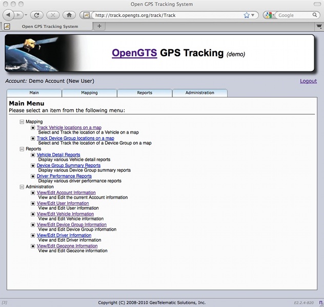
| Main Menu: |
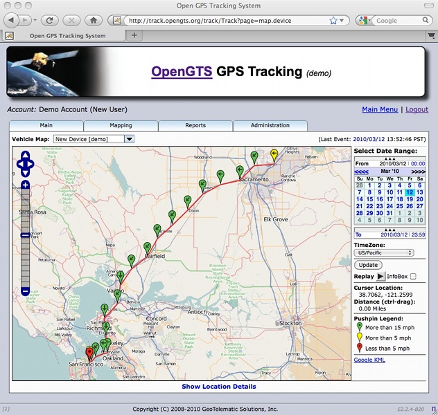
GPS Tracking Map: |
 |
 |
See OpenGTS in action at
http://track.opengts.org/track/Track
Licensing:
OpenGTS is licensed under the
Apache Software License, version 2.
According to the terms of this license, anyone may freely download and distribute the tools and
information released here.
Additional Features:
The "GTS Enterprise" is the
commercial GPS tracking/telematic system built upon the capabilities of OpenGTS®.
Click here to find out more about the "GTS Enterprise".
|
News
2020/02/20: New Release
OpenGTS_2.6.7
New StatusCodes
New Device fields
GISGraphy5 support
OAUTH2 SMTP support
Route segment colors
|
2018/09/10: New Release
OpenGTS_2.6.6
New StatusCodes
New Device fields
Code fixes
|
2017/10/09: New Release
OpenGTS_2.6.5
New StatusCodes
New Device fields
UnwiredLabs support
|
2017/04/13: New Release
|
2016/10/03: New Release
OpenGTS_2.6.3
Leaflet map support
Support for fuel tank#2
Login Password Options
|
2016/06/10: New Release
OpenGTS_2.6.2
Generics update to Java7
Update report columns
Bug fixes
Astra DCS update
|
2016/01/17: New Release
OpenGTS_2.6.1
New StatusCodes
New CheckInstall checks
Fix report index map link
TK10X DCS changes
|
2015/09/24: New Release
OpenGTS_2.6.0
New StatusCodes
New CheckInstall checks
Update astra/tk10x DCS
|
2015/05/17: New Release
OpenGTS_2.5.9
New StatusCodes
New Device/Driver fields
Minor bug fixes, etc.
|
2015/02/13: New Release
OpenGTS_2.5.8
CelltracGTS/Server
plugin support,
New status-sodes,
bug fixes, etc.
|
2014/10/08: New Release
OpenGTS_2.5.7
Compiles with Java-8
DCS "tk10x" update,
bug fixes, etc.
|
2014/06/30: New Release
|
10/12/2010: FamousWhy
Editors Pick Award
|
12/07/2009: SourceForge
|
|